Accurate Existing Records
Capture walls, structure, equipment, services, levels, openings, and visible conditions in a model aligned to the registered point cloud.


SEC Global Engineering LLC transforms laser scan and point cloud data into accurate, structured BIM models for renovation, retrofit, expansion, facility management, and construction coordination.
Our Scan to BIM team develops Revit, CAD, IFC, and documentation outputs that reflect existing site conditions with a clearly defined level of detail, model tolerance, coordinate strategy, and deliverable scope. Every model is built to help architects, engineers, contractors, and owners make decisions with confidence.
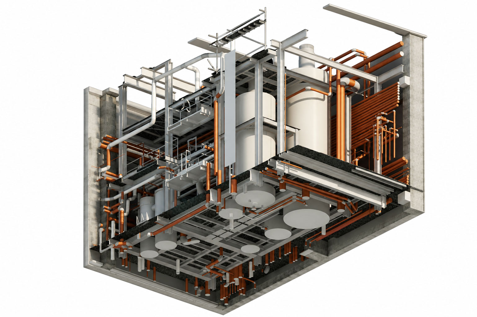
A scan is only valuable when it becomes usable project intelligence. We organize geometry, data, and documentation so teams can plan, coordinate, fabricate, and maintain with fewer assumptions.
Capture walls, structure, equipment, services, levels, openings, and visible conditions in a model aligned to the registered point cloud.
Support adaptive reuse, tenant improvements, expansions, restoration, and retrofit design with dependable base information.
Use the model for clash review, design coordination, spatial planning, prefabrication checks, and constructability discussion.
Deliver structured model data, drawings, and exports for owners, operators, facility teams, and future project phases.
SEC Global can model a single discipline or develop a coordinated multi-discipline existing-conditions package.
Walls, floors, roofs, ceilings, doors, windows, stairs, rooms, facades, finishes, and key architectural features modeled to the agreed LOD.
Columns, beams, slabs, foundations, bracing, framing, openings, and exposed structural systems captured for engineering review and retrofit planning.
Visible ductwork, pipework, equipment, cable trays, fixtures, plant rooms, risers, and service routes modeled for design coordination.
Plans, elevations, sections, reflected ceiling plans, equipment layouts, CAD exports, and model-derived documentation.
Cloud-to-model comparison views, tolerance notes, scan coverage limitations, and documented areas requiring site confirmation.
Project-ready models and files prepared for downstream design, coordination, quantity review, owner records, and facility workflows.
Our process keeps assumptions visible and deliverables measurable from the first file review through final issue.
Assess point cloud coverage, registration quality, coordinates, density, formats, reference drawings, and requested model uses.
Confirm LOD, accuracy tolerance, disciplines, naming rules, exclusions, drawing set, output formats, and review milestones.
Create architectural, structural, and MEP elements directly against scan slices, viewpoints, and registered point cloud references.
Check model alignment against the cloud, flag deviations, document uncertain areas, and resolve review comments.
Provide Revit, IFC, DWG, PDF, Navisworks-ready exports, drawing sheets, and validation notes as agreed.
Not every project needs the same level of detail. We align the model to its purpose, whether the output is a schematic existing-conditions base, a detailed renovation model, a clash-ready MEP environment, or an owner handover record.
SEC Global documents tolerances, scan limitations, modeled versus non-modeled elements, and coordination assumptions so project teams understand exactly how the BIM can be used.
Office, retail, hospitality, mixed-use, and tenant improvement projects.
Occupied facilities where existing services, access, and phasing matter.
Plant rooms, production areas, platforms, pipe routes, and equipment zones.
Detailed digital records for sensitive renovation and conservation planning.
SEC Global Engineering LLC combines point cloud interpretation, BIM production, structural understanding, MEP awareness, and documentation control into one responsive service. Our team is built for project teams that need accuracy, speed, and clear communication.
From a small interior renovation to a large multi-building survey, we scale the team around your scope, review cycles, and downstream use of the model.
Clear answers before converting point cloud data into an as-built BIM model.
We can review common scan and exchange formats including RCP, RCS, E57, LAS, LAZ, PTS, PTX, XYZ, and other registered point cloud exports. We will confirm the best workflow after checking file size, registration, and project requirements.
Accuracy is agreed at project start and checked through cloud-to-model overlays, sampled measurements, section comparisons, and documented tolerance reports.
We deliver Revit, IFC, DWG, PDF, Navisworks-compatible exports, as-built plans, sections, elevations, and cloud-to-model validation reports.
Yes. We can model architectural, structural, and visible MEP systems individually or as a coordinated existing-conditions package, depending on scan coverage and the agreed scope.
Yes. Deliverables can be issued by floor, building, zone, discipline, priority area, or milestone so design and construction teams can begin using approved information while later areas are still in production.